WELL, WE MADE IT THROUGH IKE WITH ONLY HIGH WINDS & 2-4 INCHES OF RAIN. WE WOKE UP TO BEAUTIFUL SKIES

THERE ARE A LOT OF LIMBS DOWN ALL OVER THE YARD. THANKFULLY THE 150 YEAR OLD RED OAK IN OUR FRONT YARD DIDN'T FALL THIS WAY!
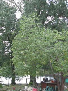 OUR TRANSMITTER IS OFF THE AIR RIGHT NOW DUE TO 5 FT. HIGH FLOOD WATER SURROUNDING OUR TRANSMITTER SITE. WE HAVE HAD A RECORD WEATHER YEAR SO FAR HERE IN ARKANSAS. HERE IS SOME INFO FROM THE NATIONAL WEATHER SERVICE IN NORTH LITTLE ROCK, ARKANSAS
On February 5th, killer tornadoes took the lives of fourteen people...with one tornado tracking a record 122 miles! Heavy snow blanketed northern and western sections of the state on March 6th/7th, with accumulations over a foot in some areas.
Then the flooding began after more than eight inches of rain fell in parts of the north and west on March 17th through the 19th. Area tributaries such as the Buffalo, Spring, Black and White Rivers experienced Top 10 crests on record.
A dozen tornadoes were spawned on April 3rd/4th across central sections of the state...including the Little Rock (Pulaski County) area. There were high water problems as well. This was followed by more heavy rain/flooding on April 8th through the 10th.
Why So Active?
A La Nina (cooler than normal water in the equatorial Pacific Ocean) pattern was in place as 2008 began. The southern branch of the jetstream (the Subtropical Jet), which normally flows south of Arkansas during the Winter/early Spring months, was drawn northward. This provided more warmth and moisture than usual, with incoming storm systems energized and producing more extreme weather events than normal. The severe weather season (usually from March through May) also got an early start, with tornadoes in January. This was also the case in 1999 (a La Nina year), with 56 tornadoes on the 21st/22nd (a record outbreak in Arkansas).
Killer tornadoes returned on May 2nd, with seven people lost. Five of the deaths were caused by a tornado that tracked 45 miles. More tornadoes followed about a week later (on the 10th), mainly in central and southern Arkansas.
Thus far, 70 tornadoes (a preliminary total) have been counted in Arkansas. In a normal year, there are 26 tornadoes.
THIS DOES NOT INCLUDE 2 TROPICAL STORMS, AND MORE TORNADO'S & FLOODING.THANKS FOR READING, & SIGN UP TO FOLLOW MY POSTS.HERE'S WHAT OUR DOG, POOH BEAR THINKS ABOUT THE WHOLE MESS RON
RON


